Colonel Hill Airport
Appearance
This article needs additional citations for verification. (April 2021) |
Colonel Hill Airport | |||||||||||
|---|---|---|---|---|---|---|---|---|---|---|---|
| Summary | |||||||||||
| Airport type | Public | ||||||||||
| Location | Colonel Hill, Crooked Island, Bahamas | ||||||||||
| Elevation AMSL | 5 ft / 2 m | ||||||||||
| Coordinates | 22°44′44″N 074°10′56″W / 22.74556°N 74.18222°W | ||||||||||
| Map | |||||||||||
 | |||||||||||
| Runways | |||||||||||
| |||||||||||
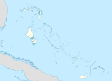
Colonel Hill Airport (IATA: CRI, ICAO: MYCI), also known as Crooked Island Airport, is an airport in Colonel Hill on Crooked Island in the Bahamas.
Airlines and destinations
[edit]| Airlines | Destinations |
|---|---|
| Bahamasair | Nassau, Spring Point[2] |
References
[edit]- ^ "Airport information for MYCI". World Aero Data. Archived from the original on 5 March 2019. Data current as of October 2006. Source: DAFIF.
- ^ https://www.flightconnections.com/flights-from-colonel-hill-crooked-island-cri Flight Connections Retrieved 1 February 2022

